


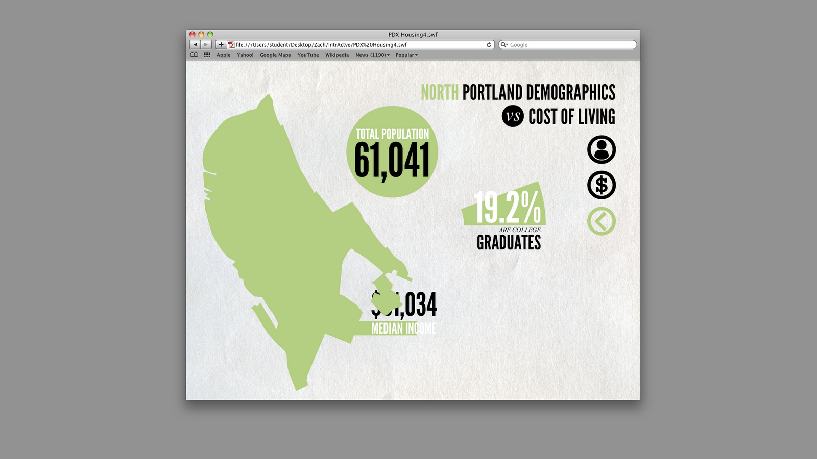

Basically, for my final infographic I wanted to use interactivity to convey more information about the neighborhoods in Portland. The print version color coded and rated Portland's neighborhoods in order of house value and cost of living, but I also wanted to reveal who lives in each of the neighborhoods to see if it there was any correlations. The new information gives total population, percentage of college grads and their median income. I couldn't figure out how I could upload the swf to the blog so here are a few screen shots of some of the features.
No comments:
Post a Comment